Rescue Systems
.
Rescue Systems
.
.


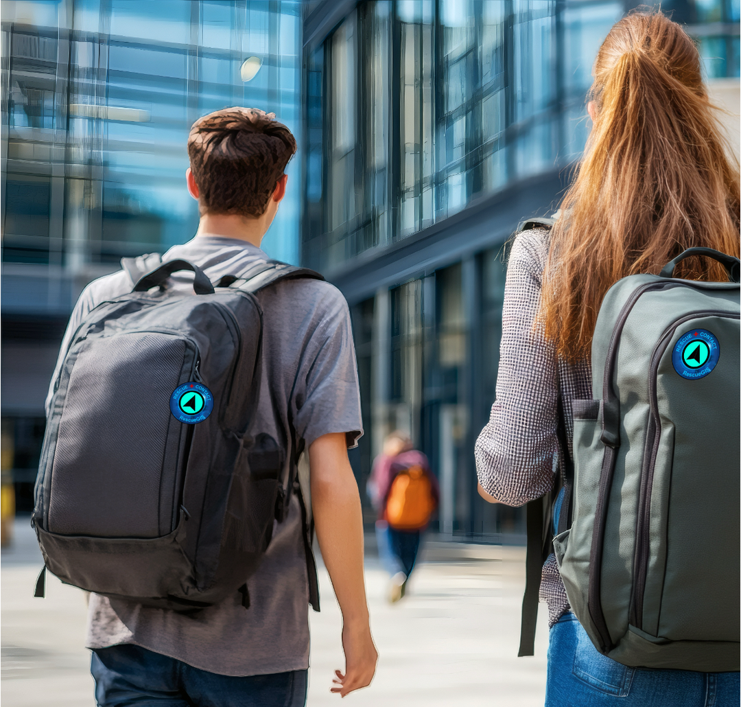
Nearest Rescue-Contacts
Come Help In Seconds
Neighbors Just Around the Corner
Lend a Helping Hand

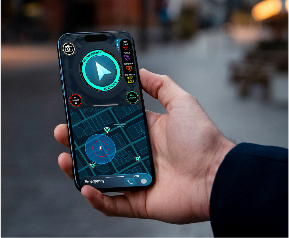
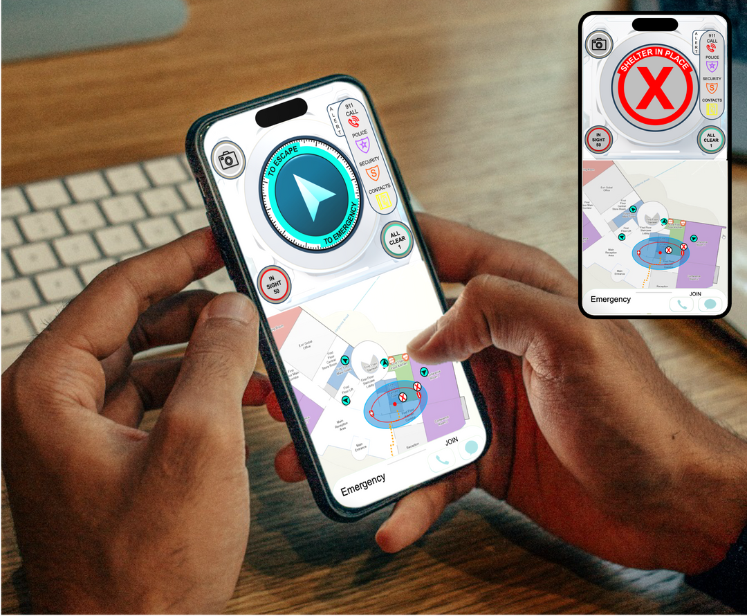
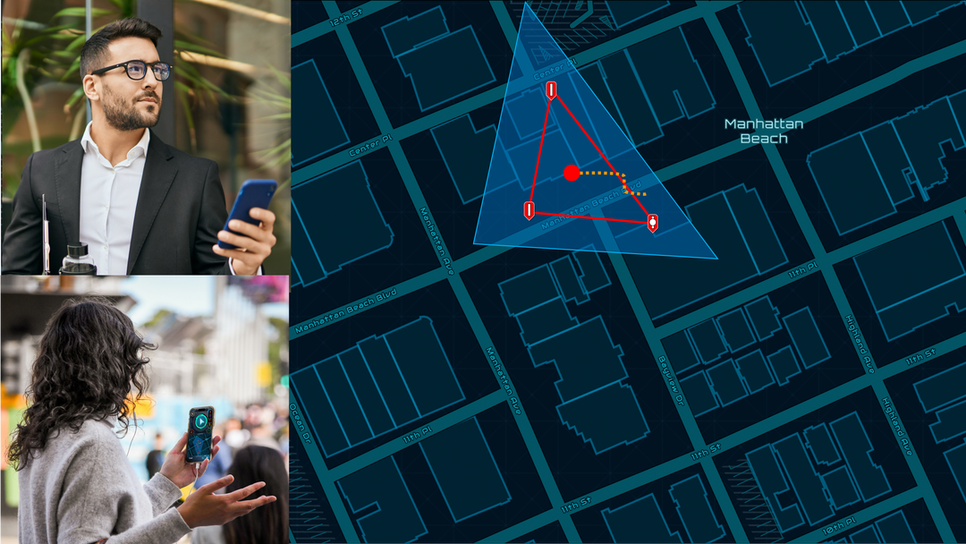
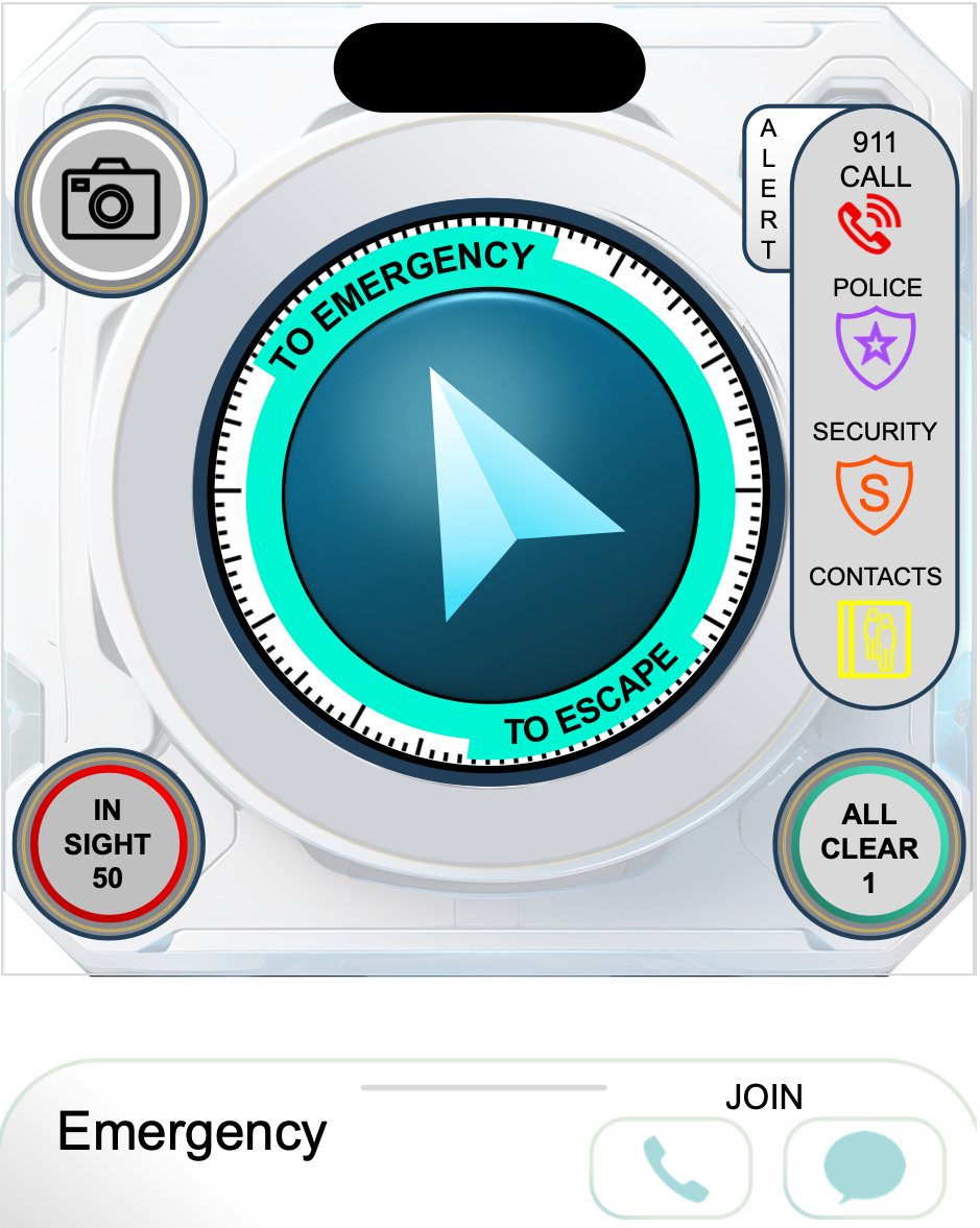
Escape with In-Hand Arrow to Safety

Shops Next Door
Look Out for Each Other
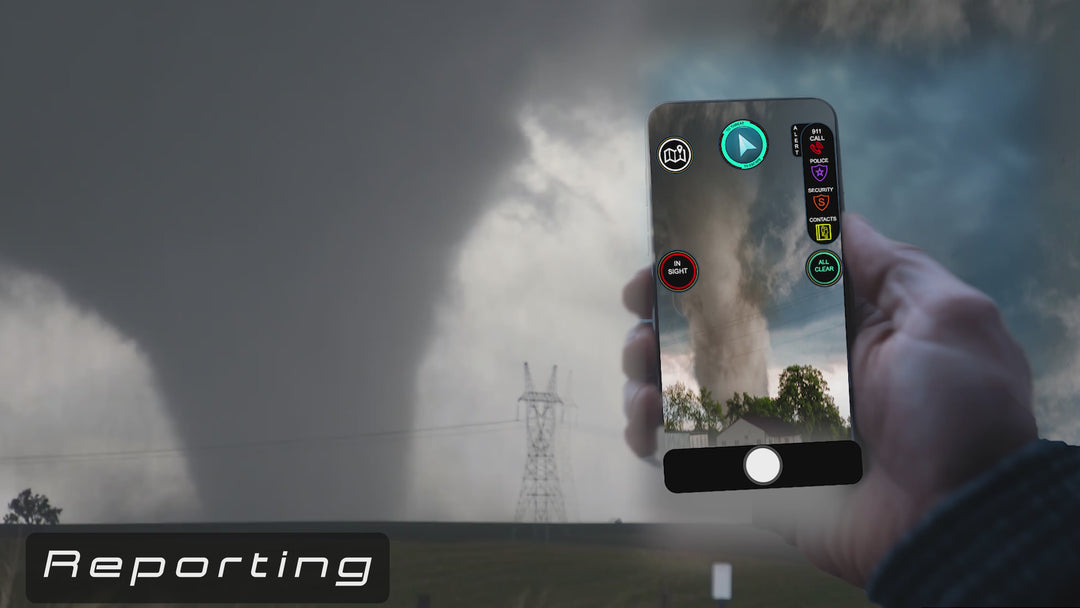
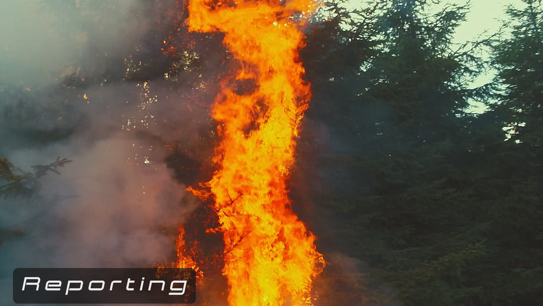
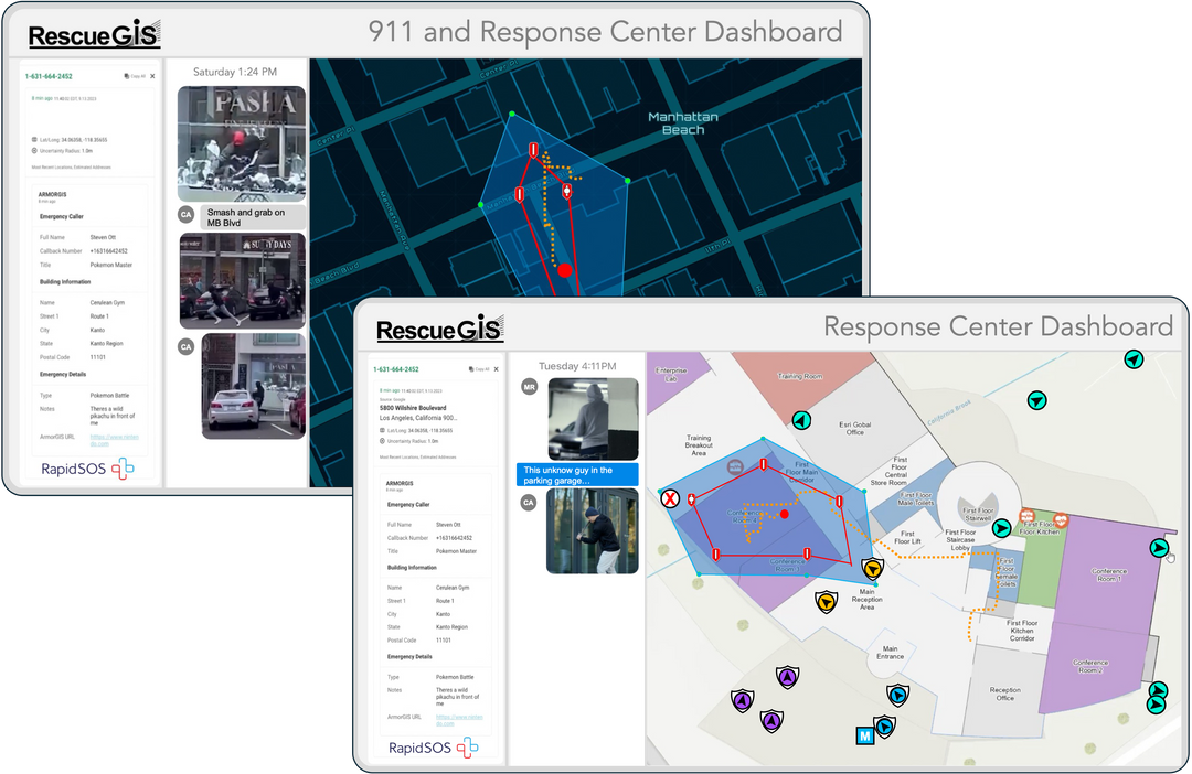
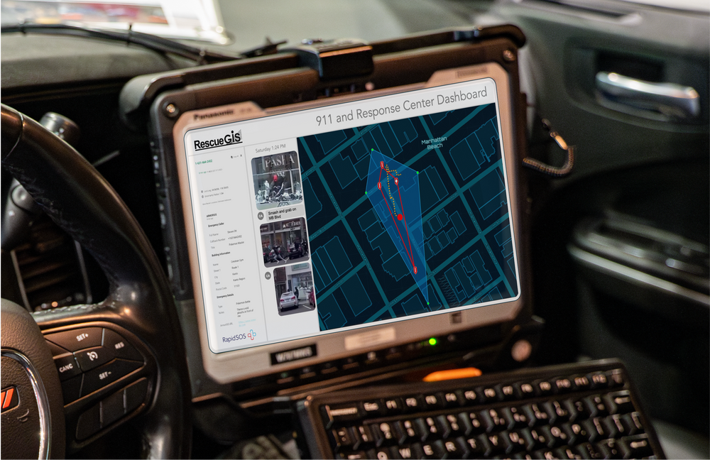
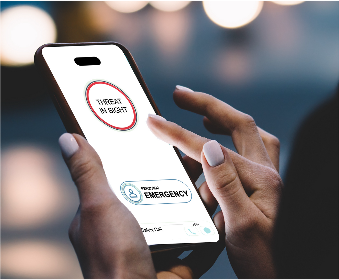
Very Early Reporting... Sent to 911
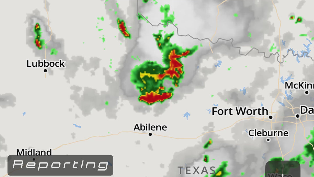
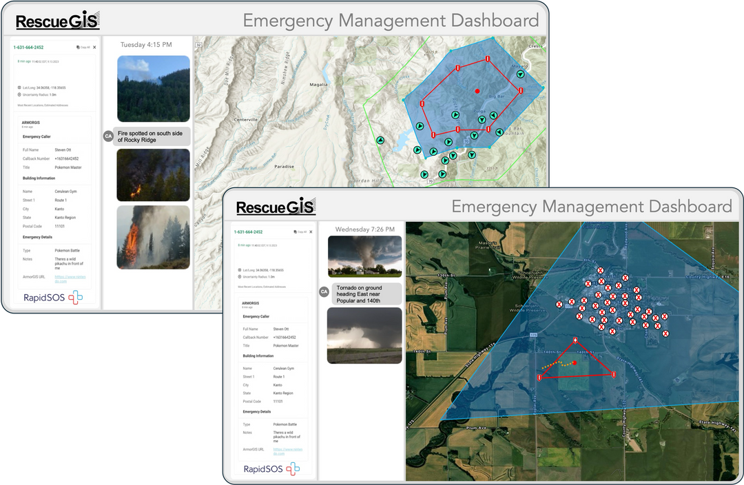
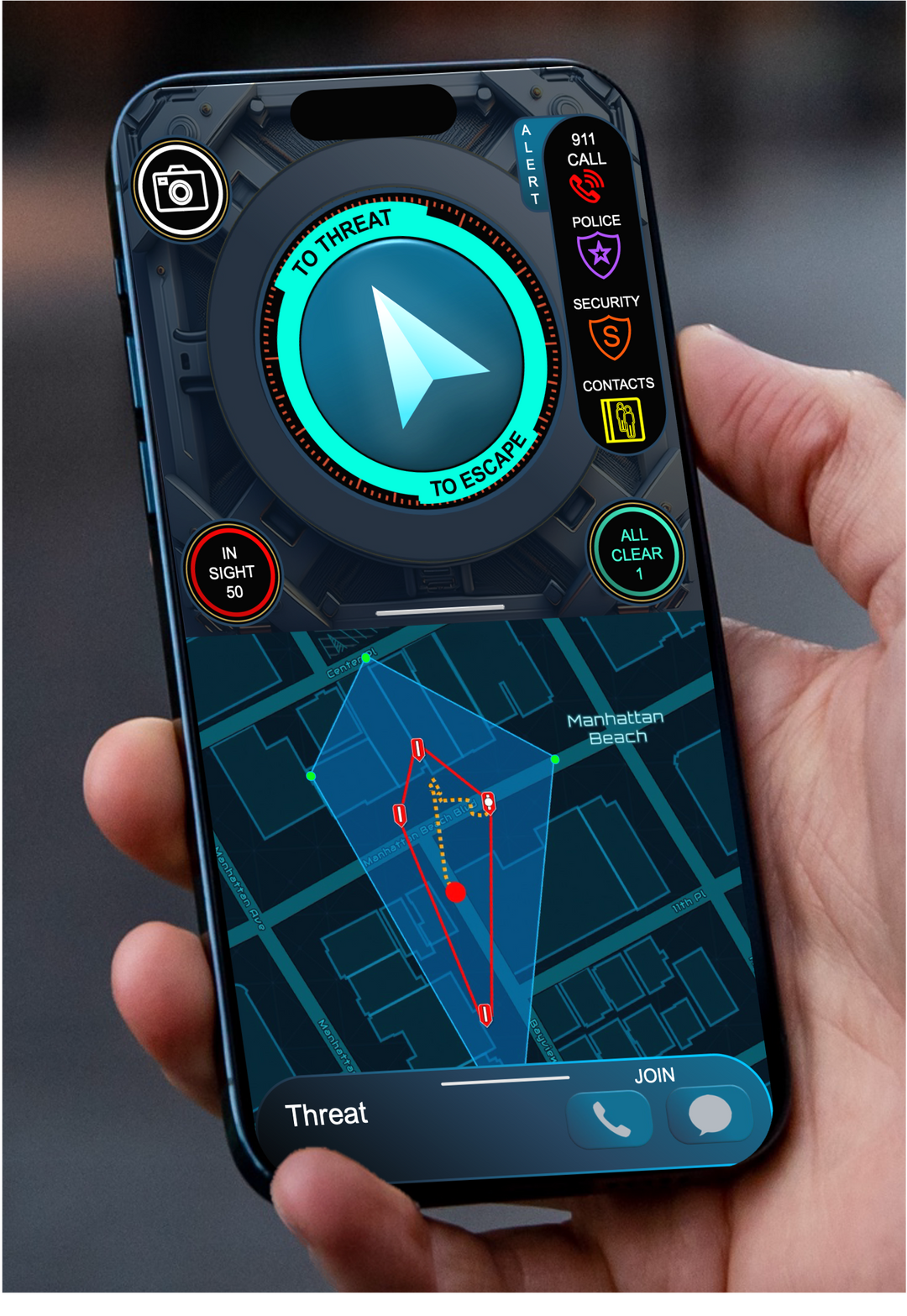
Threat Movement Tracking
Verified With On-Scene Images
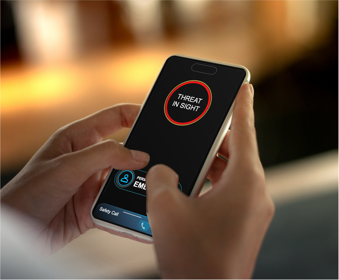
Your Nearest Personal
Rescue-Contacts are Notified
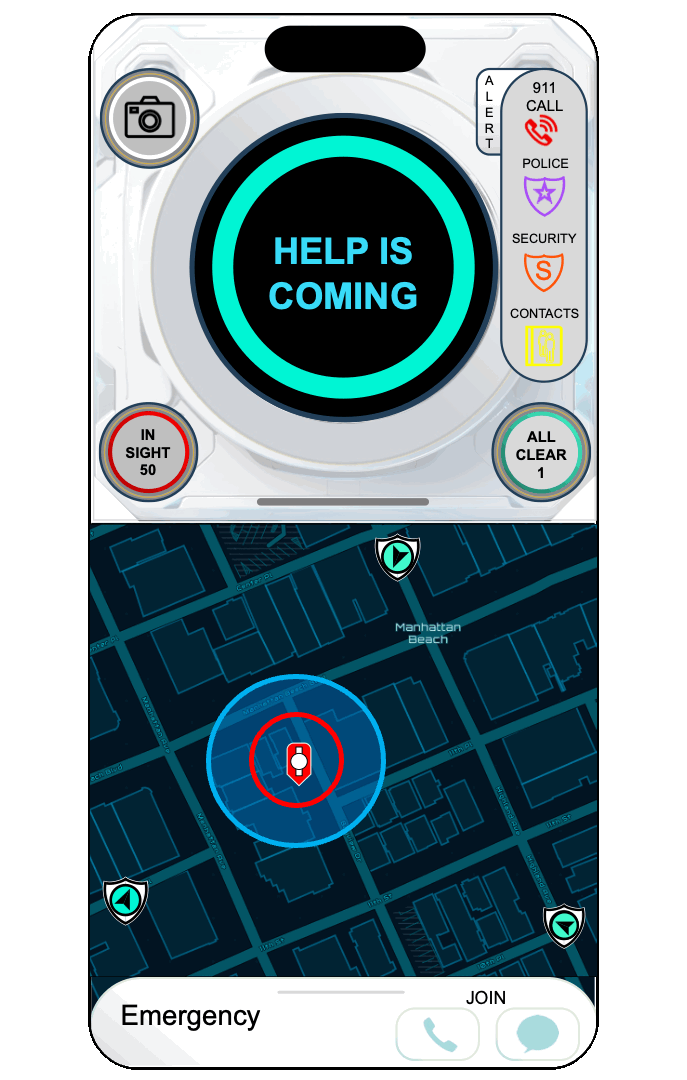
Rescue Location
Join Group Call, Text and Images
Send to 911

Group Call, Texts, and Images
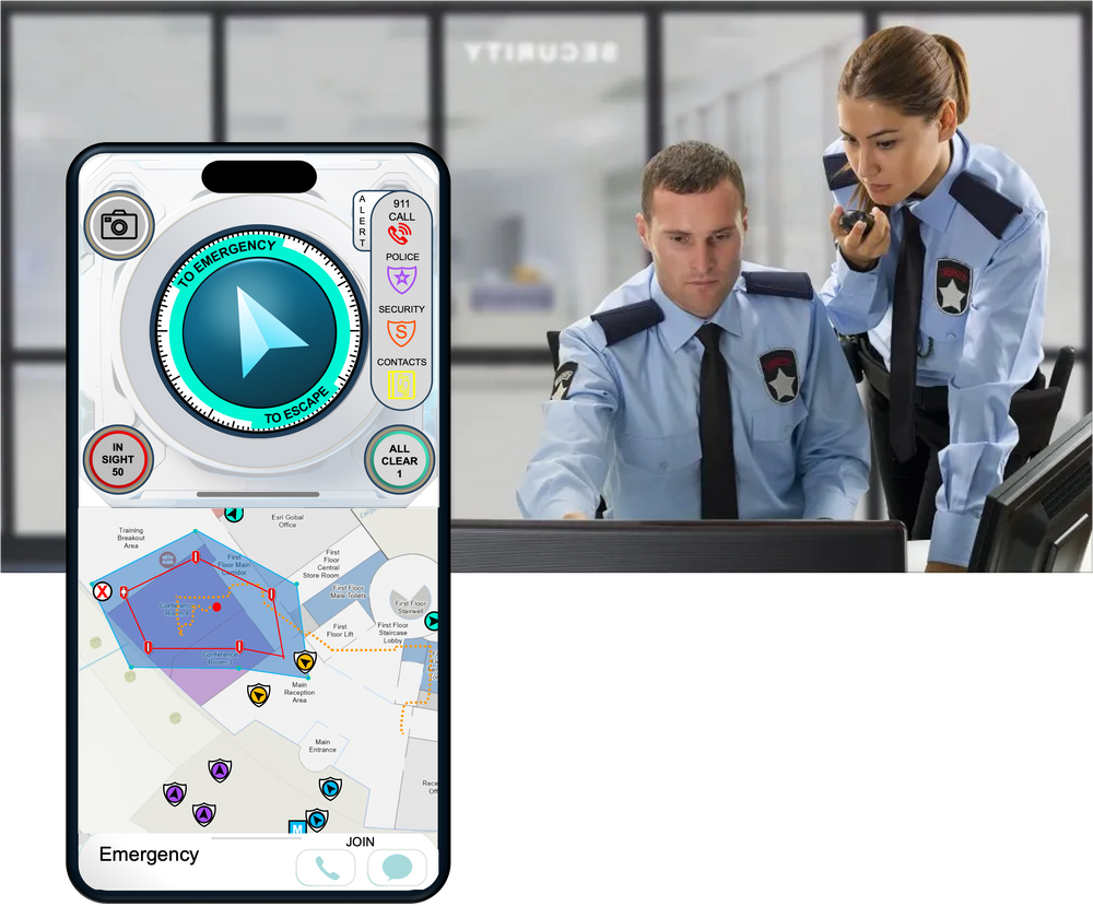
Smart Site Security
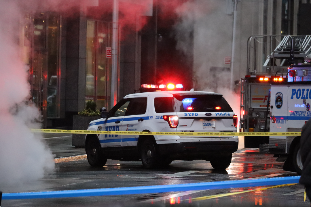
Smart City Police
Every 911 Center Nationwide


Nearby Personal Rescue-Contacts Are There To Help


Safety families not only at work and school… but everywhere.

Neighborhood and Community Engagement Technologies

Memberships Products
RescueGIS is an advanced rescue system. A personalized lifeline to your nearby responders, ensuring help is within reach… or the location can be sent to 911. It’s accessed with a phone or wearable. In disasters, emergency managers can define community areas at risk and alert people, guiding them with an in-hand arrow to safety. It helps responders react faster and even prevent tragedies before they unfold-- in schools, homes, and communities.
RescueGIS first alerts your nearest three rescue-contacts providing them options to help, such as your location and the responder’s locations. Often, they can help and all is resolved. A group call and text are opened enabling communications. Or you and your responders can send the information to your 911 center.. It enhances emergency response by providing critical real-time information, such as your location and live on-scene imagery, directly to responders before they arrive.
The Emergency Alert System does just that, alerts you of a threat. RescueGIS is a Rescue System… enabling your nearest personal rescue-contact to provide assistance or escalate to 911. Our rescue system ensures help is always within reach and in disasters groups of people are alerted by emergency managers and those in danger guided to safety with an in-hand arrow or with an X to shelter in place.
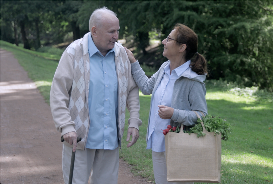
RescueGIS is designed to be used by everyone. For some it is a critical component for their safety, quickly addressing falls or medical concerns. Others seek enhanced personal safety and immediate action if confronted with a threat. For caregivers it's tool to help them and more importantly provides the peace of mind they can still help when they are away. In disasters and unexpected dangers, emergency manager can communicate with civilians and helps us all.
Yes, it could not be easier for the person in need of help. It can be initiated automatically by a health monitoring wareable or with a single button click. On the phone two buttons are presented, with a click of either, help is coming. RescueGIS is primarily a rescue system providing capabilities to responders.