Skip to content
icon-X
Close menu
Home
Sites/Campus
Smart Cities
Law Enforcement
911 Emergency Communications
Emergency Management
Trafficking Prevention and At-Risk Care
Indoor IoT
Products
Contact
About
About
Our Story
Log in
instagram
Instagram
LinkedIn
Cart
icon-X
Close cart
Your cart is currently empty.
Home
Sites/Campus
Smart Cities
Law Enforcement
911 Emergency Communications
Emergency Management
Trafficking Prevention and At-Risk Care
Indoor IoT
Products
Contact
About
About
Our Story
account
Log in
icon-search
Search
icon-hamburger
Site navigation
icon-bag-minimal
Cart
Search
Search
Emergency and Disaster Management
icon-filter
Filter
How It Works
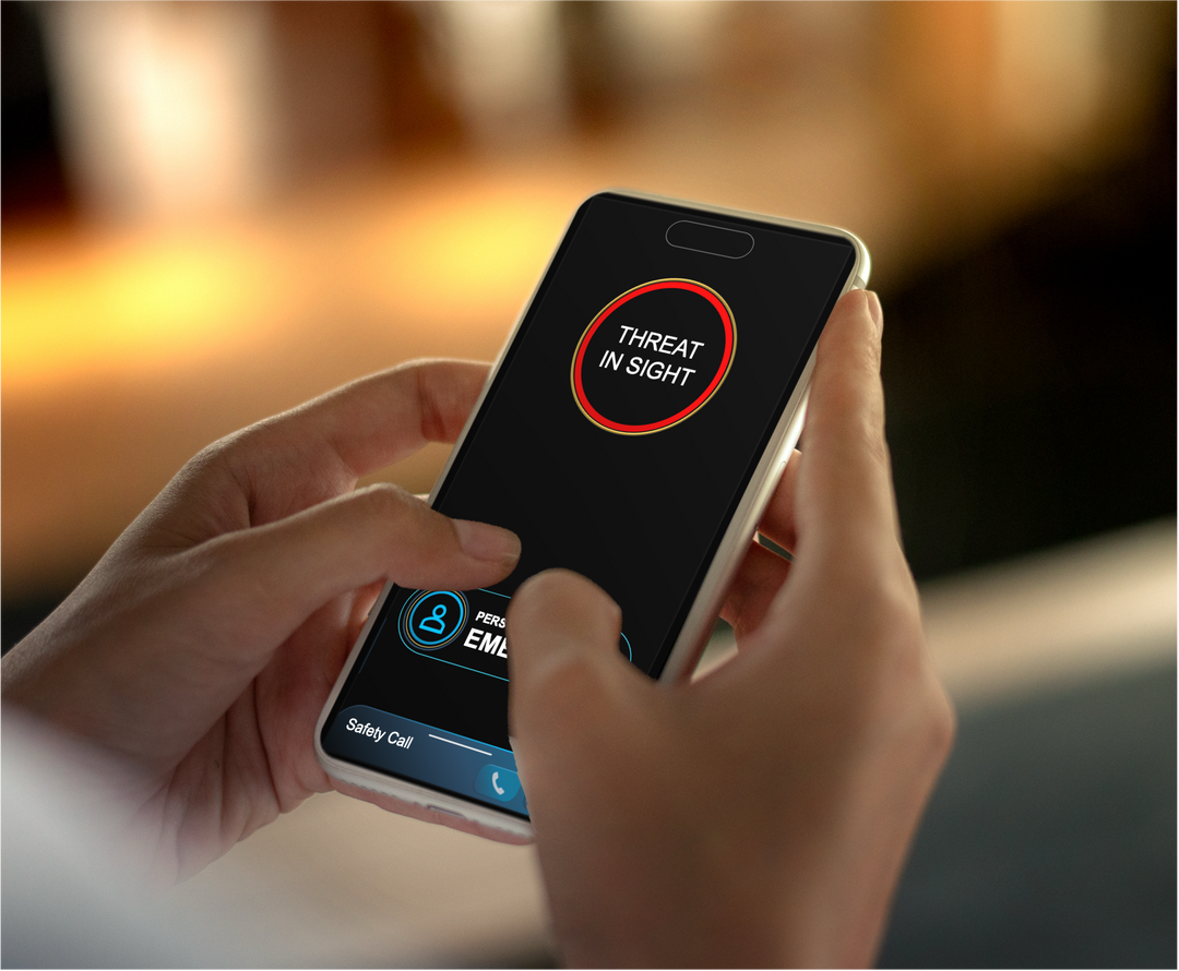
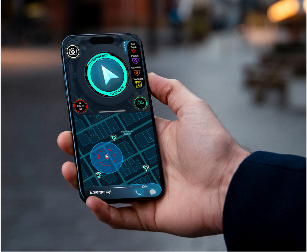
Very Early and Automated Alerts
Personal Lifeline of Responders
How It Works Story Map
Nearest Responders Engage in Seconds
Subscriptions
PRE-ORDER Individual Membership... Plus 9 No-Cost Memberships for Family and Friends
$36.00
PRE-ORDER RescueGIS Private Security Membership... for Family and Security Personnel, up to 100 devices
$4,800.00
icon-X
"Close (esc)"
icon-chevron-left
icon-X
icon-chevron
icon-X
Emergency and Disaster Management